Prestige Park Ridge Location
- Village: Anekal
- Taluk: Bangalore South
- District: Bengaluru Urban
- PIN Code: 560083
- Latitude: 12.837753
- Longitude: 77.584326
About Bannerghatta Road
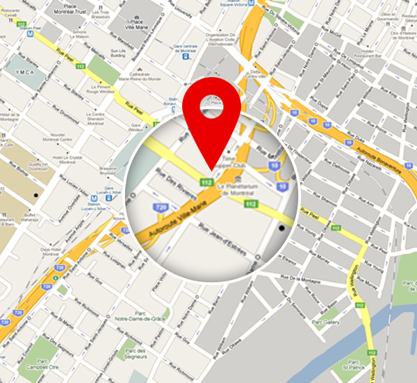
The location of Prestige Park Ridge is Anekal, Bannerghatta Road, Bangalore, Pin code 560083. The Google Plus code of the Prestige Park Ridge Location Map is FH67+9X. It has a latitude of 12.837753 and a longitude of 77.584326.
The project enjoys a key location near the major IT hubs of Whitefield, with seamless access to the best schools, colleges, shopping centres, malls, and other important city landmarks.

The exact address of Prestige Park Ridge is Anekal, Bannerghatta Road, South Bangalore, Karnataka 560083. This address is registered under Bangalore South Taluk in Bangalore Urban district. The address’s latitude is 12.837753, and its longitude is 77.584326.

Prestige Park Ridge location is on Bannerghatta Road, which is one of the top areas of Bangalore with excellent connectivity. The project location is a prime locality in South Bangalore that has easy access to all modes of transport via road, rail, metro, and air. It is connected to all key areas of the city through a wide network of roads, including NICE Road, Hosur Road, NH 48, NH 275, and Outer Ring Road.

The project location is connected well through major highways, and the nearest bus stop is just 5 minutes away. There are BMTC buses and cabs near the project location, which makes it easy for the residents to get to all areas of Bangalore.
- Sampangiram Nagara bus stop – 180 m

Prestige Park Ridge has easy access to the major stations of the Green Line of Namma Metro. The closest Metro Station to this project location is Kalena Agrahara Metro Station, and it can be reached in 15 minutes.
- Kalena Agrahara metro station – 11.9 km

The project location offers easy access to prime railway stations, which makes commuting to all other cities easier. The nearest railway station enables proper access to all other states in a short time.
- KSR Bengaluru City Junction – 22.3 km

Residents of Prestige Park Ridge can use NH 48 to get to Kempegowda International Airport. The project location is only a 1-hour and 5-minute drive from the Bangalore airport via NH 48.
- Kempegowda Airport – 58.2 km

The National Gallery of Modern Art spans over 3.5 acres and was started on 18 Feb 2009. It has 500+ exhibits of graphic prints, paintings, and sculptures, featuring works of famous painters like Jamini Roy and Raja Ravi Varma. The gallery also has a garden with green space, trees, fountains, and a mirror pool.

HAL Heritage Centre, started in 2001, spreads over 4 acres of land. It showcases aircraft and fighter planes, and includes a kids' play area, a rose garden, and a library. Ticket prices are Rs 70 for adults and Rs 30 for kids. The museum is open daily from 9 AM to 5 PM.

Cubbon Park was created in 1870 under Major General Richard Sankey. It is a green lung in the city center, hosting museums, a tennis academy, a library, an aquarium, a toy train, and many statues. It also has natural rock outcrops, thickets of trees, grassy expanses, and bamboo groves.

Founded in 1970, Bannerghatta National Park is famous for wildlife safaris, a rescue centre, zoo, and butterfly park. The park covers 260.5 sq km and includes a Lion Safari, a snake park, and a Tiger Safari. Open daily from 9:30 a.m. to 5 p.m. (except Tuesday).

Named after India's first Prime Minister, the Jawaharlal Nehru Planetarium is a great place for kids. It is one of five Nehru Planetariums in India. The 42-minute sky theatre show uses digital projectors over a 15-meter dome, providing an exciting journey through the solar system.

Bannerghatta is a town in South Bangalore, famous for its proximity to IT hubs like Electronic City. The real estate market is growing fast due to good connectivity via SH 87 and NH 48. Bannerghatta map highlights the area’s location advantages and reduced travel times.
Bannerghatta is a sought-after residential area with access to multiple modes of transport. The road network and BMTC bus services enable hassle-free commuting. Nearby railway stations provide travel to other cities in India. The upcoming metro and easy airport access make it convenient for frequent travellers.
Bannerghatta Road is well connected to other parts of the city through a network of highways and roads, including:
- NICE Road
- Hosur Road
- NH 48
- Outer Ring Road
- NH 275
- Bellary Road
- Begur Road
- Dairy Circle
- MG Road
Bannerghatta Road does not have a direct metro network yet, but it connects with stations on the Green Line of the Metro. The upcoming phase of the Pink Line Metro will include a direct metro station, improving connectivity further.
Kempegowda Airport is the nearest airport, easily accessible via major roads. Cab services are available in the area for convenient travel to the airport.
- Mount St Joseph – 6.7 km
- Holy Spirit School – 5.2 km
- EuroSchool – 6.3 km
- The Little Crest – 7.9 km
- Podar School – 5.2 km
- Greenwood High School – 7.7 km
- Progient Labs – 4.7 km
- BPL – 11.6 km
- Kalyani Magnum Tech Park – 4.2 km
- Infosys – 6.5 km
- Accenture Services – 12.9 km
- Shrum Tech – 4.2 km
- Oracle – 6.7 km
- IBC Park – 5.5 km
- Royal Meenakshi Mall – 5.2 km
- Vega City Mall – 5.2 km
- Gopalan Innovation Mall – 6.6 km
- Shoppers Stop – 4.7 km
- Apollo – 1.2 km
- Jayadeva – 3.2 km
- Aster RV – 7.8 km
- Fortis – 3.8 km
- Rainbow Children’s Hospital – 8.2 km
- Electronic City – 10.2 km
- JP Nagar – 8.2 km
- Whitefield – 29.3 km
FAQS
The project is on Bannerghatta Road, South Bangalore.
The airport is 58.2 km from this project.
Kalena Agrahara metro station is the nearest station. It is 11.9 km from the project.
The nearest bus station is the Sampangiram Nagara bus stop. It is 180 m from the project.
Some major roads that connect the project are Outer Ring Road, NH 275, NICE Road, and NH 48.
Prestige Park Ridge Blog


